Fake Maps
The communist regimes used fake maps to prevent people from fleeing to the West
România Internațional, 28.06.2021, 11:36
The communist regime used all possible means to silence its opponents. The passive ones, who, exasperated, were trying to leave and settle in the western free world, were also discouraged in every possible way: from being shot on the spot, to receiving life sentences and being manipulated and blackmailed. The communist border, symbolised by the Berlin wall, literally killed people, in cold blood. But besides the border as such, another means was used, subtler than physical violence: the fake map.
In September 1964, at a consultative conference of the Socialist states, held in Moscow, a decision was made for those countries’ maps to be falsified, distorted and printed inaccurately. The regime thought that tricking those who wanted to flee by having them use fake maps, which would take them straight into the arms of the repressive apparatus, was preferable to physical liquidation. East Germany was in direst need of such maps. And taking care of that particular aspect was the job of the dreaded intelligence service, the Stasi. The Romanian political police, the Securitate, liked the method and took it over.
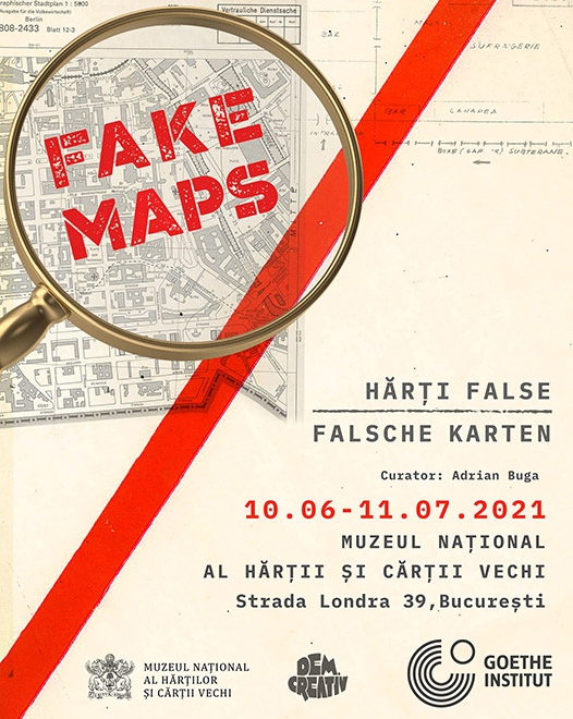
The German Cultural Centre in Bucharest has organizedan exhibition titled Fake Maps, bringing together maps from the Stasi and Securitate archives. Facsimile of the fake maps used by the former German Democratic Republic and the former Socialist Republic of Romania were exhibited to show visitors one of the methods used by the communists to hinder any attempt at fleeing the country by those who could no longer endure the oppression of the regime.
Curator Adrian Buga was the one that organized the exhibition. As he told us, a fake map drawn up before 1989 was aimed first and foremost at depriving people of the freedom of movement:
I would put the sign of equality between a map and knowledge. Once you reach a new territory, whether we are talking about this planet or an extraterrestrial space, that knowledge can be used. And then, who has that knowledge, who has that plan, who has that map is also in control. At the same time, if you know how to control that information and you don’t want it to fall into the hands of your enemies, you falsify it. Another aspect of fake maps is that they are misleading when you want to escape from a space and need guidance. A map equals orientation, the information must come from a source that we consider credible. But in this case, that source we trust is falsified and used to our detriment.
The fake map of the regime had to change the inner map of the individual. It falsified not only topography but also perceptions and beliefs about the outside world.
Adrian Buga: From certain points of view we can say that the falsified map is specific to closed, totalitarian regimes. Once the regime controls and wants to oppress and pressure the citizens in a certain place, it must falsify the borders and it must falsify the way people perceive the place and other places from the outside. The information must be falsified to show how bad it is outside the matrix in which the regime wants to keep people and how good it is inside the matrix.
What was the mechanism by which a map was faked? Adrian Buga says that the fake map was a deliberate alteration of an accurately drawn map.
There were standard maps, topographic maps, providing information about cities, buildings, streets, about the type of soil, about rivers and so on. The standard maps were secret, no one had access to them except with certain approvals that were quite difficult to obtain. In the public space there were only tourist maps, on which certain places had been deleted or falsified. So, one would arrive at a place with the map in hand and discover that the place was completely different: either there were areas of uneven ground that did not appear on the map, or the rivers had been drawn differently in case a foreign army would want invade the territory, or just to make it difficult for the people who would try to escape and flee the country.
The Romanian security did not draw up fake maps in the true sense of the word but resorted to something much simpler: interrogations of those captured.
Adrian Buga explains: We do not have fake maps but the maps with the routes used by people to flee Romania. Those caught had to draw exactly the place where they had attempted to escape. The Securitate had to know the topography very well, mislead and discourage escape attempts. We are talking about the western border, the border with Hungary and the Yugoslav border on the Danube. There were many places there used by people to escape. There are many testimonies, and I am thinking of the book about the famous gymnast Nadia Comăneci and the Securitate. It is very interesting how Nadia describes that route and that guide, a shepherd of the place, who did not know the topography of the place.
Researching the archives revealed, in addition to fake topographic maps, another type of map: the personal map of the individual and his private space. Tens of thousands of opponents were tracked with the help of sketch maps, which included everything, from domicile to the routine of every member of the family and visitors. (MI)

