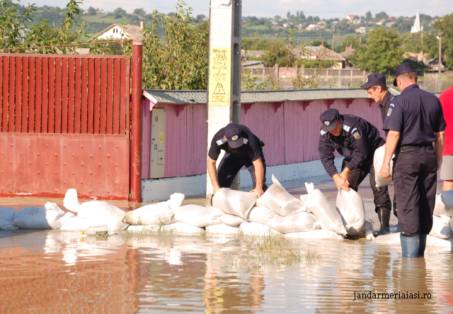
Floods – a major problem
With 6% of Romanias inhabitants living in flood risk areas, the authorities have created a flood hazard and risk map.

România Internațional, 11.04.2014, 14:05
As an EU member state, Romania has fulfilled its obligation to implement a European directive on flood risk evaluation and management.
The flood risk maps for 11 hydrographic basins in Romania have been finalised, the head of the “Romanian Waters” National Administration, Vasile Pintilie, told a press conference on Thursday. The areas most vulnerable to flooding are the Siret lower basin, in the east, the Banat area, in the south-west, and the area of confluence of the rivers Prut and Danube, in the south-east. Bucharest’s flood risk areas are the western part of the city and its lake area.
The minister delegate for waters, forests and fishery, Doina Pana, said that by drafting these maps, Romania has fulfilled its obligation as an EU member state to implement a European directive on flood risk assessment and management. After the preliminary assessment of flood risk, this was the second step of the implementation phase whose deadline was March 2014. The risk maps were created by the “Romanian Waters” National Administration and the National Institute for Hydrology and Water Management.
This large-scale project cost 40 million euros, a sum covered through the EU Cohesion Fund, more specifically the Sectoral Operational Programme Environment. According to expects, the hazard and risk maps indicate the areas most exposed to floods, potential material and human damage, vulnerable economic activities in these areas, the major sources of pollution and the economic, cultural and social structures in these regions. The authorities say they now have the necessary instruments to come up with more accurate predictions and warnings so that every county inspectorate may step in and take the needed measures as quickly as possible. The head of the “Romanian Waters” National Administration, Vasile Pintilie explains:
Vasile Pintilie: “We are now able to report, in real time, any phenomenon that may appear and have a destructive effect on human settlements.”
The next stage is drafting flood risk management plans, whose deadline is March 2016. Minister Doina Pana:
Doina Pana: “We will first create a management plan for every hydrographic basin and then secure the building approval of the local authorities in the flood risk areas. The purpose hof these maps is to minimise the effects of floods.”
Experts estimate that carrying out flood control works at current standards requires investments of almost 3 billion euros.


